Kuntasi
I am
starting here a series of articles regarding my city Morbi. I hope to do
justice to my city and present it in its true colours of past, present and
future prospects. I wish to unravel its various aspects post by post. So guys
just check it out and please correct me any time whenever I am wrong or my perspective is wrong.
Let’s
start this with the first article from the pres-historic time. Kuntasi is a
small village and it’s a village from the times of Lothal
Kuntasi is an
archaeological site (locally known as Bibi-no-Timbo) which is identified
as a port belonging to the Indus Valley Civilization.[1] This
site is located on the right bank of Phulki River, about 3 km south-east
of Kuntasi village[2]
and 30 km from Morbi
in Maliya taluka of Rajkot District in Gujarat state of India. It is five
k.m. inlandward from present shore line. It was first reported by P. P Pandya
and later thoroughly explored by Y. M. Chitalwala. The excavations revealed two
periods of occupation. Period I is assigned to the Mature Harappan phase (c.
2200–1900 BCE) and the Period II is assigned to the Late Harappan phase
(c.1900–1700 BCE).[3]
This site was identified as a jetty and a manufacturing centre.(This article is
direct from wiki)
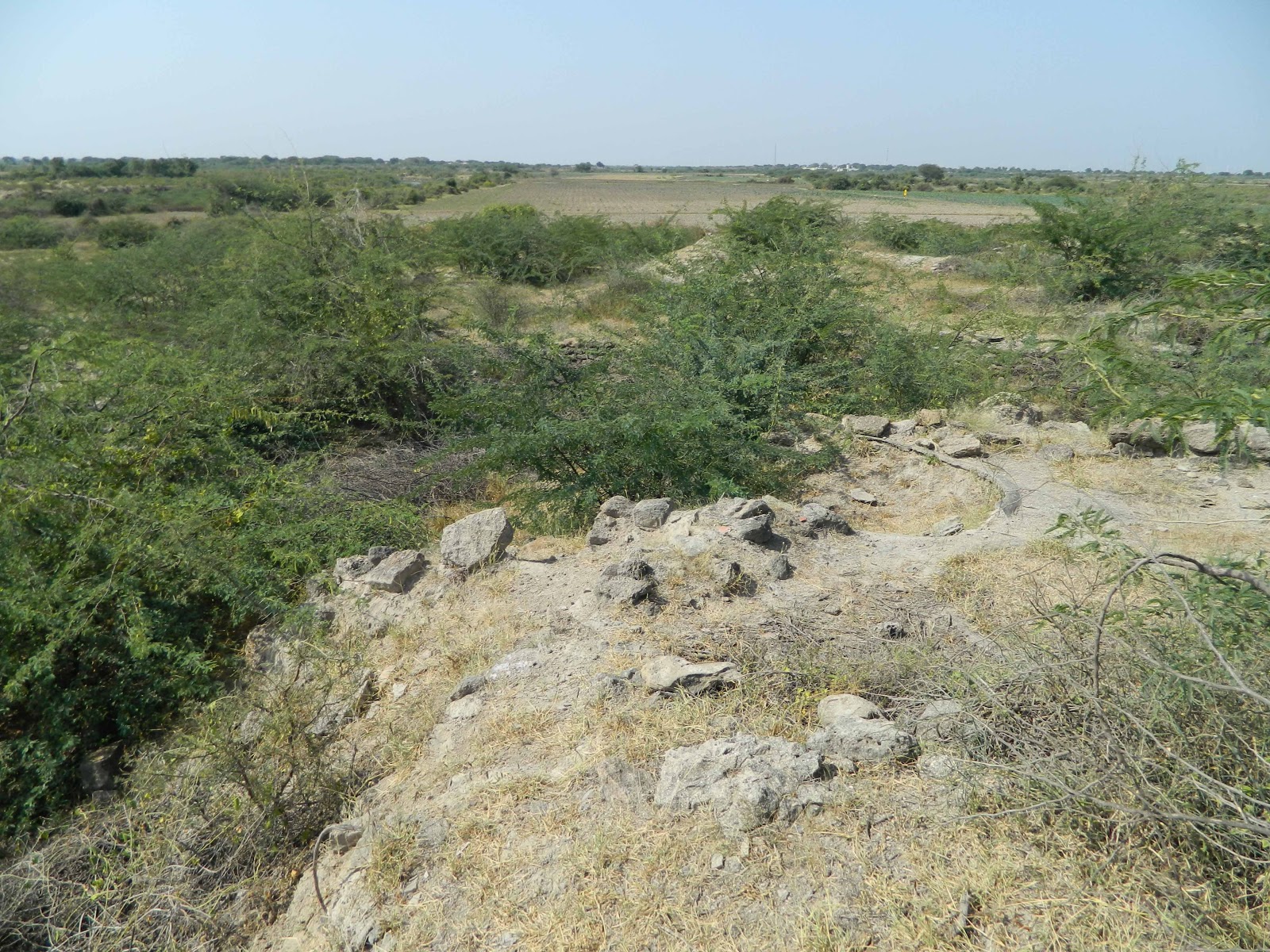
I visited this site
today only and it’s in very bad condition, there are no sign boards around.
Thorns have grown around it. What was yesteryear's port in full bloom is now in
a very sorry state. There is no effort by anyone to find out about its glory.
It’s truly said very glorious and beautiful things wither and get forgotten
with time. I refer to this site as it’s connected with the history of Morbi in
some way or other it’s hard to find out. The material available is scarce yet I
m posting some photos I took today with various references.
 |
 |
 |
 |
 |
 |
 |
 |
 |
Ancient shorelines of Gujarat, India, during the Indus civilization (Late
Mid-Holocene): A study based on archaeological evidences
|
A. S. Gaur* and K. H. Vora
Marine Archaeology Centre, National
Institute of Oceanography,
Dona Paula, Goa 403 004, India
Dona Paula, Goa 403 004, India
Changes in the shoreline at any point could be due to
various reasons such as tectonic disturbance or shift in sedimentological
regime causing erosion or deposition. Many scientific investigations, focusing
on the palaeo-shoreline vis-à-vis sea level fluctuations in India based on
numerous geological techniques, have indicated that at about 6000 BP, the
sea level was approximately 6 m higher than at present and about 4000
years BP it stabilized at the present one with minor fluctuations.

Kuntasi is another site locally known
as Bibino Timbo located about 3 km south-east of the Kuntasi
village. It is about 5 km inlandward from the present shoreline. A large
stone structure measuring 9.5 m ´ 4.1 m outside the
fortification, according to Dhavalikar et al.20 was
used as landing platform for going down to the creek for loading-unloading
cargo in boats. They further suggested that it was not an agricultural
settlement but was a centre for acquiring and processing raw materials for
manufacturing articles for export. Discovery of two cylindrical stone anchors
with tapering sides, and large holes bored vertically throughout the length and
the overall geomorphology of the area corroborate that Kuntasi could have been
a port situated at the creek mouth during the Harappan period.
http://en.wikipedia.org/wiki/Kuntasi wiki reference
Kuntasi:
a Harappan Emporium on West Coast by M. R. Raval &
Y. M. Chitalwala M. K. Dhavalikar (Jan 1,
1996)
No comments:
Post a Comment